
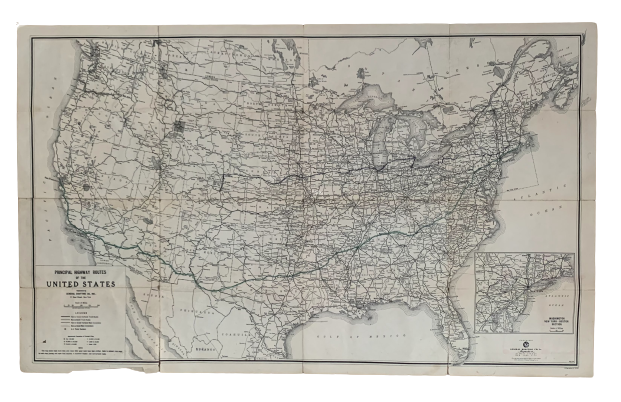
Principal Highway Routes of the United States
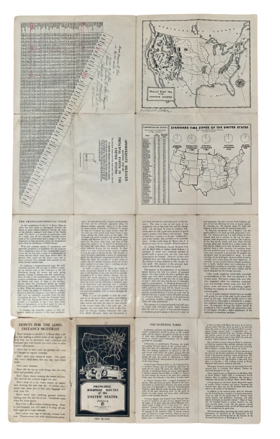
New York: General Drafting Co. Inc., [1933]. Folding map, 40x67cm, folded to 18x11cm. Good condition with toning, wear to folds, and a split to fold at bottom left panel. Former owner's annotations in pencil on both sides, with route from San Francisco to Providence traced neatly in green. Folding highway map of the US which includes inset map of "Washington, New York-Boston Section." Mileage table, text on the National Parks and the Transcontinental Tour, time zone map, and pictorial relief map on verso. Worldcat lists the date for this publication as 1931, but in the section on National Parks, the "new Trans-Mountain Highway," of Glacier National Park is mentioned, which was completed in 1933. An uncommon map. Item #4969
Price: $50.00